About the Institute
The Point Conception Institute (PCI) is a global conservation science center based at The Nature Conservancy’s (TNC) Jack and Laura Dangermond Preserve. PCI’s impact model leads to faster, more adaptive conservation in critical places.
We harness the power of open science by facilitating diverse research collaborations, data stewardship and sharing, and technology applications to protect biodiversity, restore ecosystems, and address climate change with innovative solutions.

Point Conception Institute Newsletters
As the climate crisis takes hold around the world, there is a pressing need for living laboratories where the future of resilience and sustainability can be designed.
Protected areas like Dangermond Preserve can serve as proving grounds for bold conservation action and can serve as engines of knowledge generation if their data and lessons learned circulate beyond their borders. Only by sharing data and lessons learned across geographies can we make a global impact.
The Point Conception Institute has the vision of a “Digital Twin” for conservation, where ecological data emerging from instrumentation networks, remote sensing, primary research, mobile data collection platforms, and other sources becomes open and available to the global scientific community to enable discovery, synergy, and pathways to conservation action and decision making.
Our work facilitates research collaborations, data collection and management, and technology applications to address biodiversity loss and climate change in ecosystems around the world.
Download
Featured Projects
Biodiversity
-
PCI partnered with NASA-Jet Propulsion Lab and University of California on Project SHIFT (for Surface Biology and Geology High Frequency Time series). This is a first-of-its-kind deployment of AVIRIS (Airborne Visible/InfraRed Imaging Spectrometer) optical sensor technology and on-the ground vegetation sampling to calibrate and validate vegetation observations for NASA’s Surface Biology and Geology (SBG) mission. This coordinated effort will, for the first time, document large-scale seasonal change in vegetation of Mediterranean ecosystems through weekly flyovers coupled with ground-based sampling. Check out the data and SHIFT media and stay tuned for emerging research.
Freshwater
-
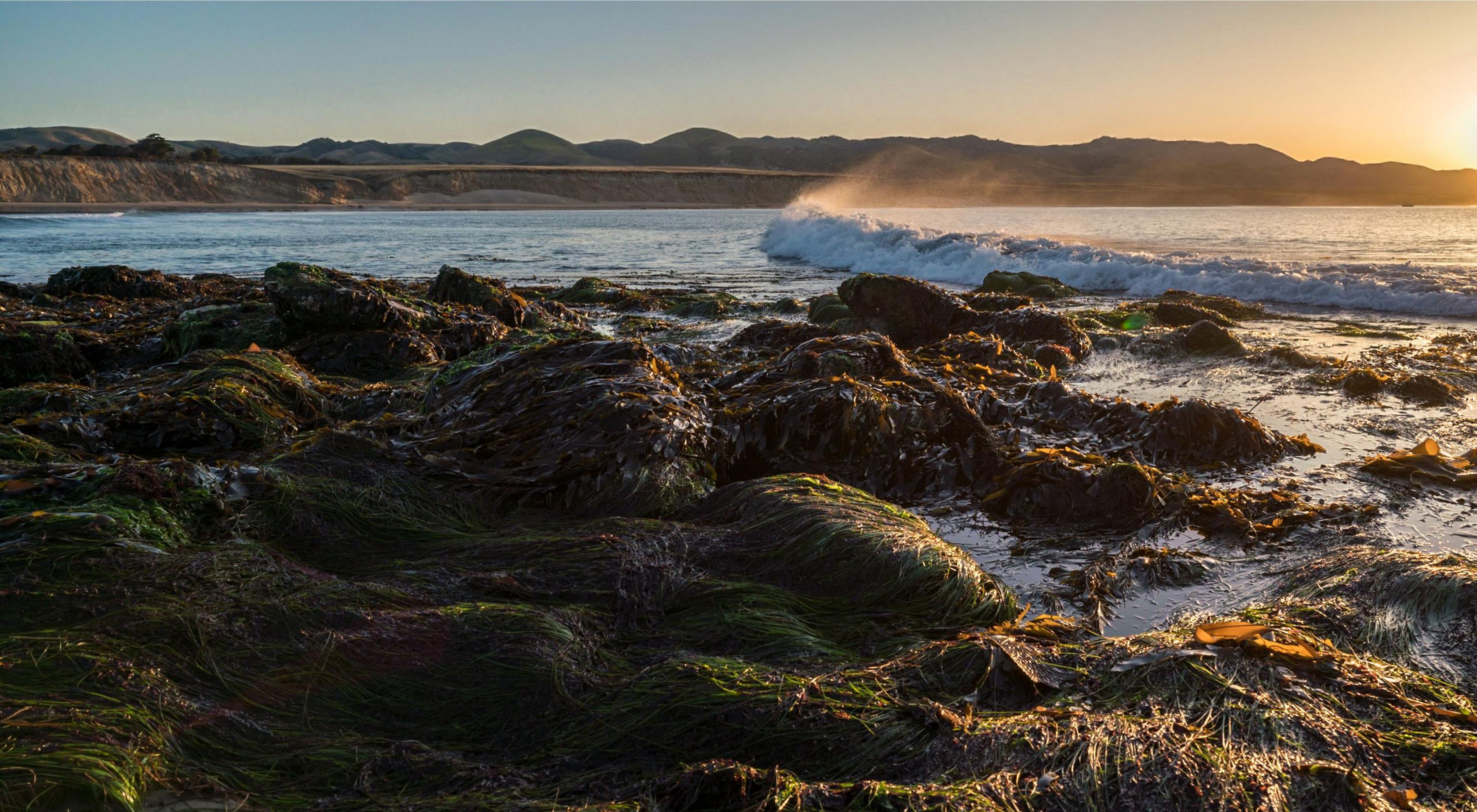
Dangermond Preserve’s Jalama watershed is a medium-sized, intact southern California watershed. Without major dams, diversions, or development, over 90% of the watershed is within The Nature Conservancy’s conservation ownership of the Dangermond Preserve. This makes it ideal for deploying a combination of ground-based, airborne, and satellite sensing to create pipelines of data on freshwater ecosystems—a freshwater digital twin.
Through the development of a wireless network of weather stations, stream gauges, and ground water level loggers, and in situ sampling of isotopes and water quality we are working with partners (UCSB, etc) to understand the “pulse” of the Preserves freshwater resources and use information pipelines to make sustainable water decisions.
Specifically, our goal is to:
- Develop data and evidence to guide conservation actions in ecologically similar, but more impaired, watersheds (e.g., impaired watersheds throughout the global Mediterranean biome).
- Create and demonstrate efficient, technologically-enabled approaches for monitoring data-poor freshwater systems.
- Create a rich database (digital twin) to allow for new approaches and integration of insitu data with airborne and satellite technologies for water system monitoring.
- Invest directly in developing scalable approaches by convening water resource managers and decision makers, presenting approaches, data and findings and determining the impact pathway forward.
PCI and Our Collaborators
The Point Conception Institute will facilitate collaborations between TNC; Esri; University of California, Santa Barbara; National Aeronautics and Space Administration (NASA); National Geographic Society; Smithsonian Institution; Vandenberg Space Force Base; National Center for Ecological Analysis & Synthesis (NCEAS) and other institutions to support and accelerate research initiatives. Specific examples of our research collaborations include the deployment of Esri mobile data collection tools to support field research, and the development with NASA of new approaches for applying satellite-based information to manage freshwater, coastal, and terrestrial ecosystems and conserve biodiversity.

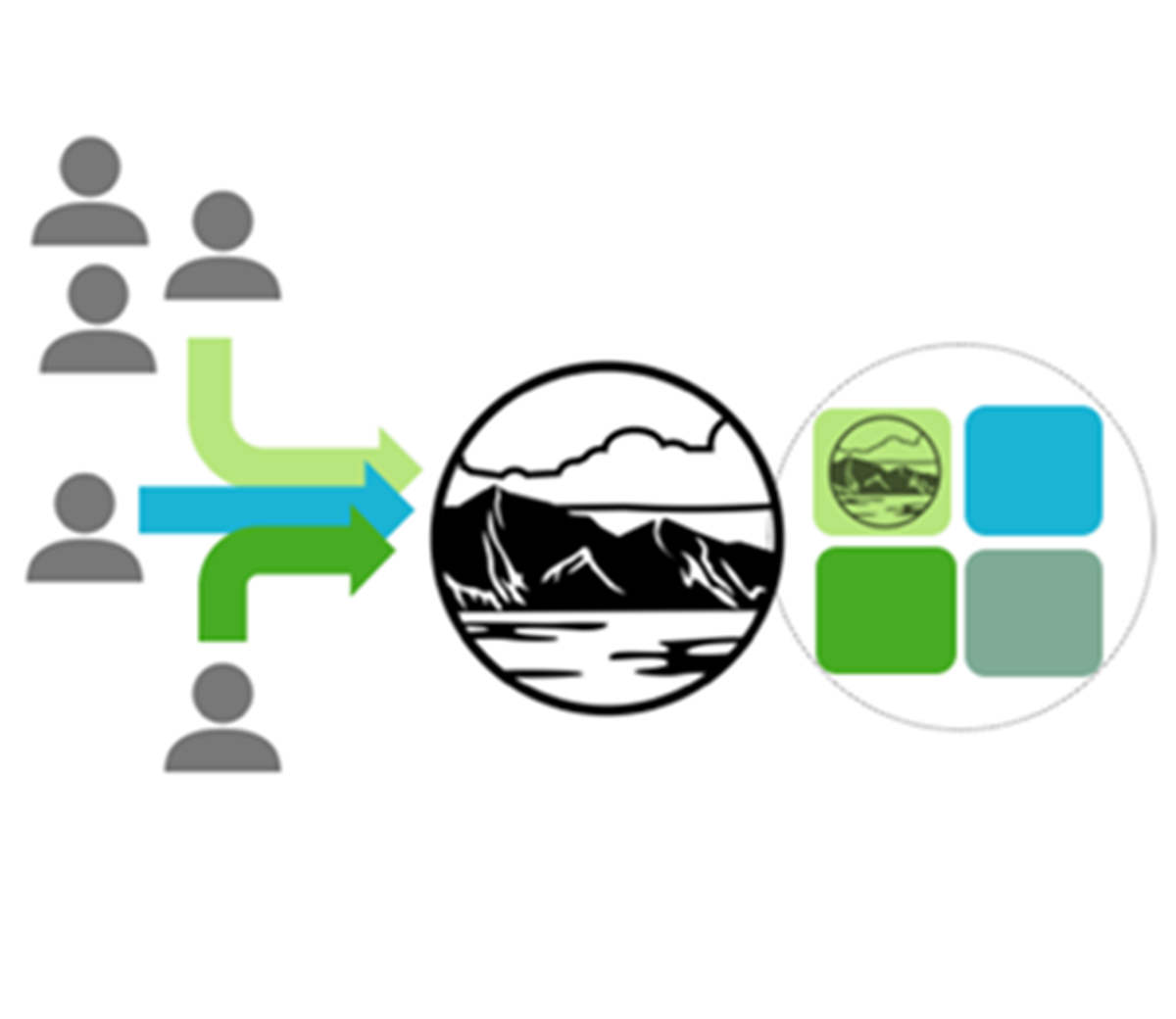
PCI's Impact Model visualization


Mark Reynolds: Director of the Point Conception Institute in California. © TNC
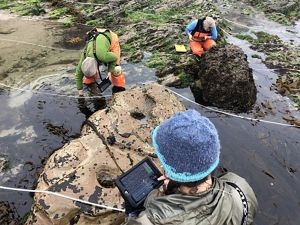
Intertidal Research: UCSC researchers use iPads to enter over 3,300 data entries along transects during low-tide intertidal biodiversity surveys. © Walter Heady/TNC
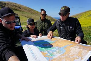
Dangermond Preserve Map Review: TNC scientists review a map at Dangermond Preserve. © Aliya Rubinstein/TNC
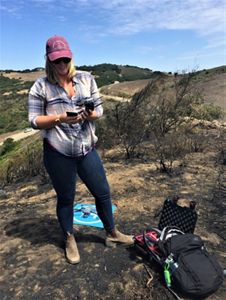
Science in action: PCI Director of Conservation Technology, Kelly Easterday, flying UAV over Jalama Road after fire. © Mark Reynolds/TNC
Beach camera trap: Elizabeth Hiroyasu and Moses Katkowski with coastal wildlife camera. © Erin Feinblatt/TNC
Kelly Easterday: Director of Conservation Technology at the Jack and Laura Dangermond Preserve and Point Conception Institute. © TNC
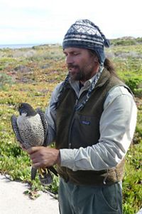
Biologist Nick Todd and bird: Biologist Nick Todd tags a peregrine falcon at the Dangermond Preserve. © Jay Carlson/TNC
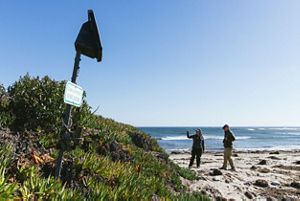
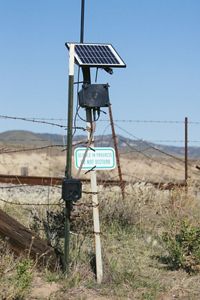
Camera Trap: Camera trap at the Dangermond Preserve. © Erin Feinblatt
Ecosystem Overview: Mark Reynolds, PCI Director, provides an overview of Dangermond Preserve’s ecosystems. © TNC
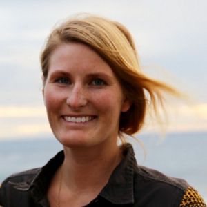
Rae Wynn-Grant : Wildlife ecologist and fellow at the Point Conception Institute. © Rae Wynn-Grant

Research Publications
Click the button below to find a list of publications related to research and reports from the Dangermond Preserve and the Point Conception Institute.